

You can find on this page the Germany airports map to print and to download in PDF. The map of Germany airport presents details of location and international airports of Germany in Europe.
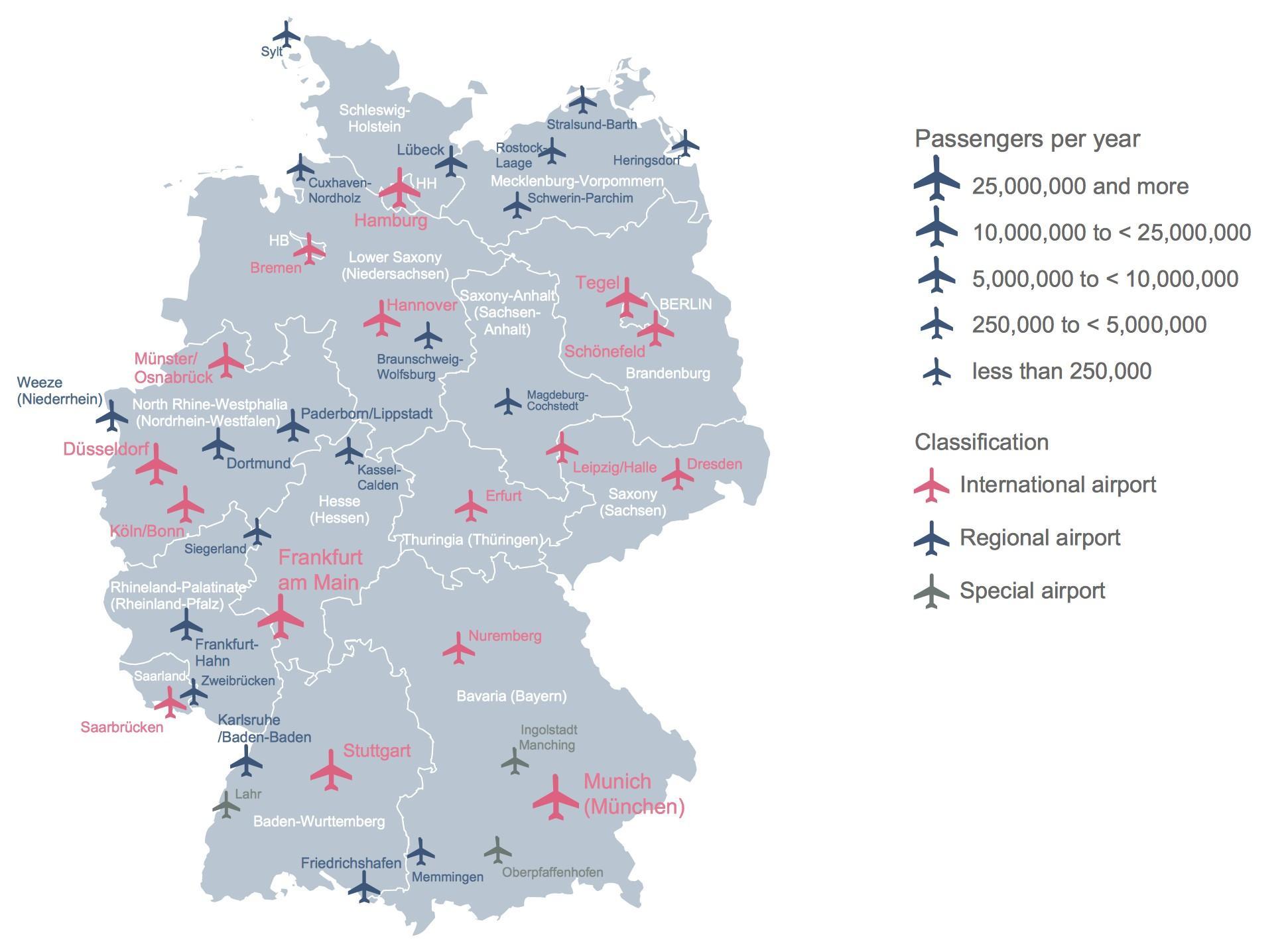
The Germany airports map shows location of airports in Germany. This airports map of Germany will allow you to determine which airport you will used to leave or arrive in Germany in Europe. The Germany international airports map is downloadable in PDF, printable and free.
Frankfurt International Airport is Germany largest airport and a major transportation hub in Europe. Frankfurt Airport ranks among the world top ten airports as its mentioned in the map of Germany airports. It is one of the airports with the largest number of international destinations served worldwide. Depending on whether total passengers, flights or cargo traffic are used as a measure, it ranks first, second or third in Europe alongside London Heathrow Airport and Paris Charles de Gaulle Airport.
Germany second most important international airport is Munich. Other major airports are Berlin Tegel, Berlin Schönefeld, Düsseldorf, Hamburg, Cologne-Bonn, Leipzig/Halle as you can see in the map of Germany airports. Both airports in Berlin will be consolidated at a site adjacent to Schönefeld Airport, which will become Berlin Brandenburg Airport, to open on 17 March 2013.
Frankfurt airport, one of the world busiest, and Germany largest airport. Airports in Düsseldorf, Munich, and Berlin (Tegel) are also of major importance as its mentioned in the map of Germany airports. During the period of partition, passenger traffic from West Germany to West Berlin was restricted to the airlines of France, the United Kingdom, and the United States. After unification Berlin was opened to German carriers and indeed to carriers of other countries.