

You can find on this page the Germany region map to print and to download in PDF. The Germany political map presents states, regions, provinces and surrounding areas of Germany in Europe.
The Germany regions map shows surrounding areas and provinces of Germany. This administrative map of Germany will allow you to know regions of Germany in Europe. The Germany regions map is downloadable in PDF, printable and free.
Southwest of Berlin (Germany capital and cultural center) is Potsdam, with its famous palace and elegant gardens and parks, set in an idyllic landscape along the Havel River. Thuringia, with its untouched villages, churches, and medieval fortress ruins, has long been popular with tourists. Leipzig is the most important industrial center in the east after Berlin as its mentioned in Germany regions map. The Danube, which flows through the region of Franconia it is worth exploring for its own quiet charm. The region of the Romantic Road is known for its folk traditions, old-world charm, and unspoiled medieval towns still surrounded by their original walls. The major center of the region of Schwarzwald is Freiburg.
The Metropolitan regions in Germany are the eleven largest and most densely populated areas in the Federal Republic of Germany as you can see in Germany regions map. They comprise the major German cities and their surrounding metropolitan areas and form the political, commercial and cultural centers of the country. The eleven Metropolitan Regions in Germany were organized into political units for planning purposes.
The five most important regions in Germany, collectively often called the "big five" as its shown in Germany regions map, are frequently compared with other European metropolitan areas for investments and market development. They are (from north to south): Hamburg, Berlin, Düsseldorf, Frankfurt and Munich. The selection of these five cities is also recognized internaltionally, as Frankfurt is ranked as Germany only "α" (Alpha) global city, while Berlin, Hamburg, Munich and Düsseldorf are ranked as "β" global cities.
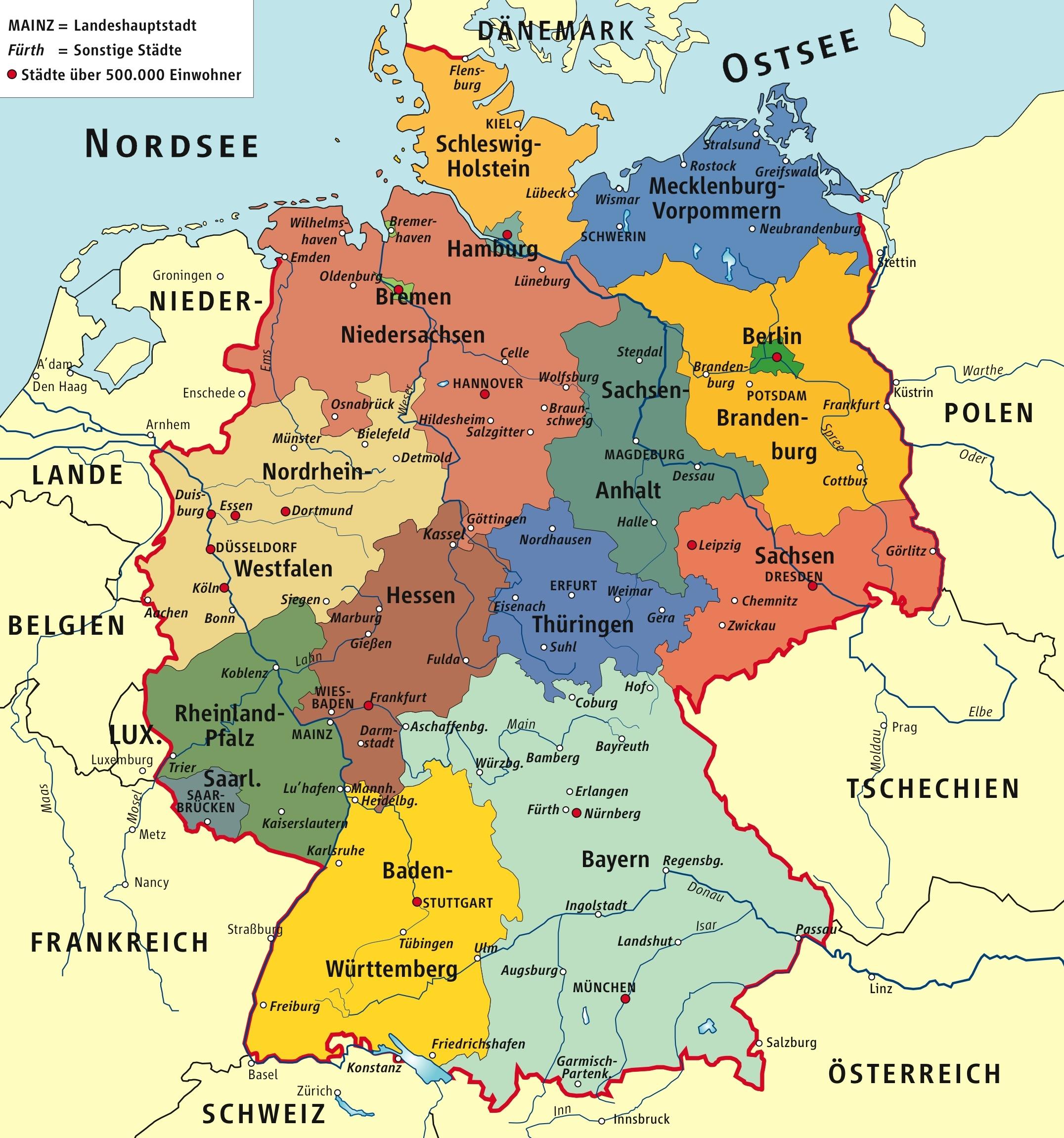
The Germany political map shows regions and provinces of Germany. This administrative map of Germany will allow you to show regions, administrative borders and cities of Germany in Europe. The Germany political map is downloadable in PDF, printable and free.
Germany is a federal, parliamentary, representative democratic republic. The German political system operates under a framework laid out in the 1949 constitutional document known as the Grundgesetz (Basic Law as its mentioned in Germany political map). Amendments generally require a two-thirds majority of both chambers of parliament; the fundamental principles of the constitution, as expressed in the articles guaranteeing human dignity, the separation of powers, the federal structure, and the rule of law are valid in perpetuity.
The Parliament of Germany, the Bundestag, has a plural multi-party system, with two major political parties, the Social Democratic Party of Germany (SPD) and the Christian Democratic Union (CDU), with its sister party, the Christian Social Union (CSU) in the same parliamentary group, also known as CDU/CSU or the Union as you can see in Germany political map. Furthermore, Germany has three minor parties, the Free Democratic Party (FDP), The Left, and Alliance '90/The Greens. The federal government of Germany usually consists of a coalition of a major and a minor party, most typically CDU/CSU and FDP, or a 'red-green alliance' of the SPD and Greens.
Coalitions in the Bundestag and state legislators in Germany are often described by party colors. Political Party colors are the Social Democratic Party being red, the Alliance '90/The Greens green, the Free Democratic Party yellow, the Left dark red or purple, and the CDU/CSU black as you can see in Germany political map.
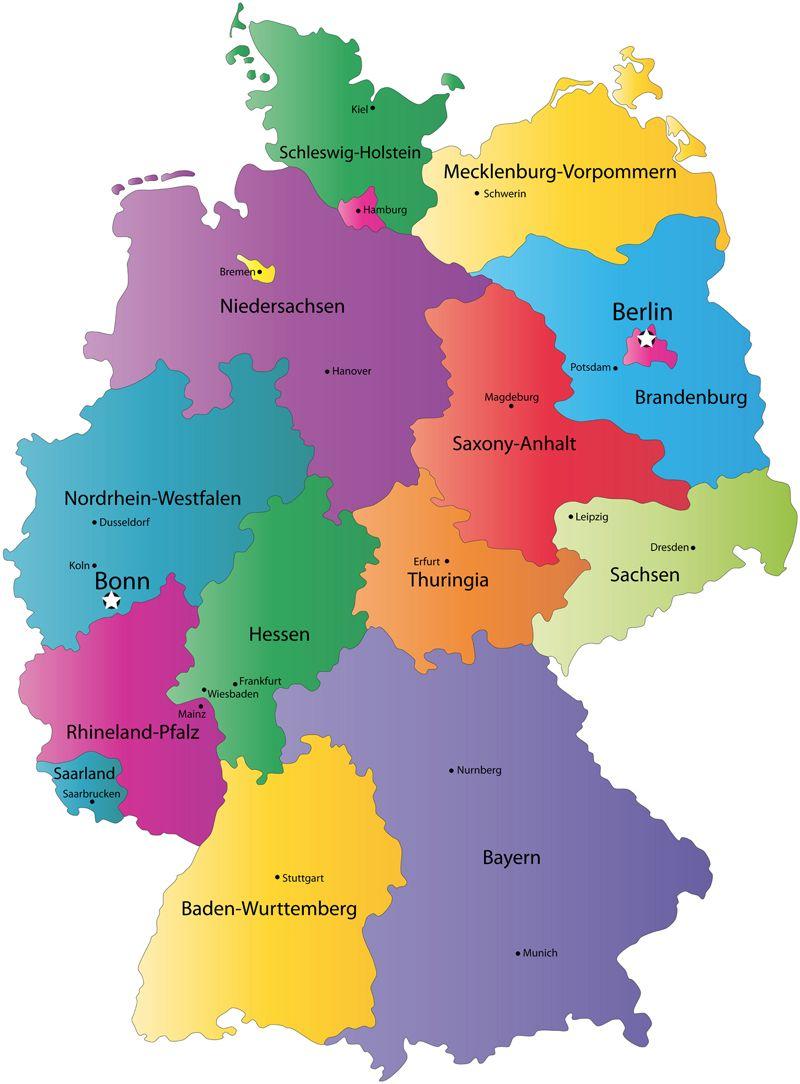
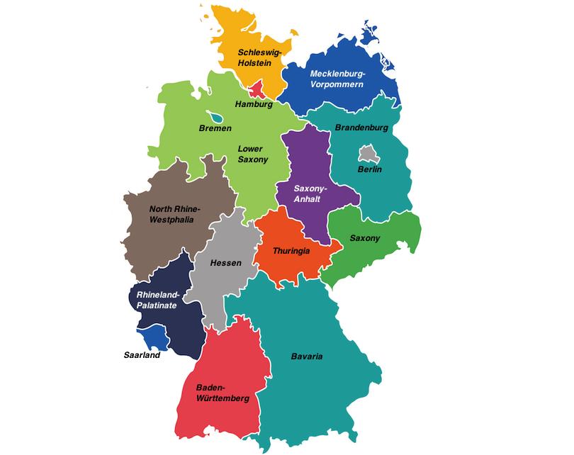
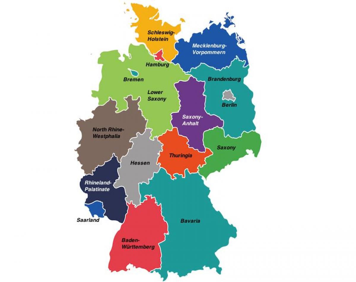
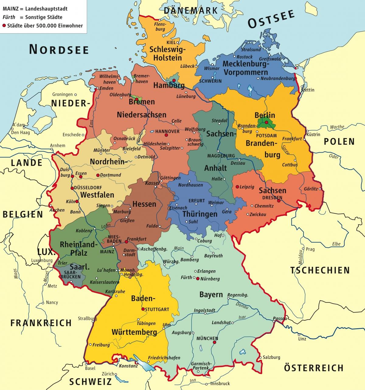
The Germany states map shows all departments and regions of Germany. States map of Germany will allow you to know areas and cities of Germany in Germany. The Germany states map is downloadable in PDF, printable and free.
Germany comprises sixteen states as its shown in Germany states map that are collectively referred to as Länder. Each state has its own state constitution and is largely autonomous in regard to its internal organisation. Due to differences in size and population the subdivision of these states varies, especially between city states (Stadtstaaten) and states with larger territories (Flächenländer).
For regional administrative purposes five states, namely Baden-Württemberg, Bavaria, Hesse, North Rhine-Westphalia and Saxony, consist of a total of 22 Government Districts (Regierungsbezirke) as its mentioned in Germany states map. As of 2009 Germany is divided into 403 districts (Kreise) on municipal level, these consist of 301 rural districts and 102 urban districts.
Each of the states of Bavaria, Saxony, and Thuringia officially describes itself as a "state" (Staat) and more specifically as a "free state" (Freistaat). Berlin, Hamburg and Bremen are frequently called Stadtstaaten (city-states) as you can see in Germany states map. The remaining 13 states are called Flächenländer (literally: area states).