

You can find on this page the Germany satellite map to print and to download in PDF. The Germany map from satellite presents new pictures of Germany as seen from the sky in Europe.

The Germany satellite map shows new pictures of Germany as seen from the sky. This satellite map of Germany will allow you to visit the country Germany in Europe as seen from the sky. The Germany satellite map is downloadable in PDF, printable and free.
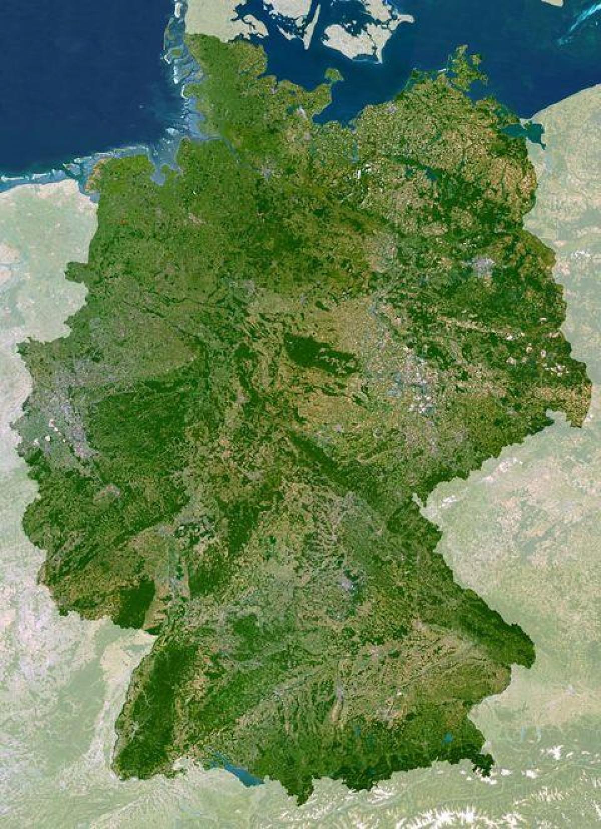
The satellite map is showing Germany as a country located in central Europe and bounded by the Baltic Sea, the North sea and Denmark in north, by the Netherlands, Belgium, Luxembourg, and France in west, Switzerland and Austria in south, the Czech Republic and Poland in east, and it shares maritime borders with Sweden, and the United Kingdom as its shown in Germany satellite map.
Germany as on satellite image lies mostly between latitudes 47° and 55° N (the tip of Sylt is just north of 55°), and longitudes 5° and 16° E. The territory covers 357,021 km2 (137,847 sq mi), consisting of 349,223 km2 (134,836 sq mi) of land and 7,798 km2 (3,011 sq mi) of water as its mentioned in Germany satellite map. It is the seventh largest country by area in Europe and the 62nd largest in the world.
The forested uplands of central Germany and the lowlands of northern Germany (lowest point: Wilstermarsch at 3.54 metres / 11.6 feet below sea level) are traversed by such major rivers as the Rhine, Danube and Elbe as you can see in Germany satellite map. Glaciers as on satellite image are found in the Alpine region, but are experiencing deglaciation.